It's cold in the night. The joys of summer-time sleeping bag near snow.
Actually it's cold from upside, downside it's warm. Under me is the
Defense League chocolate wrapping. Maybe I should wrap myself entirely
in this. About four o'clock the heating is turned on. Good, it will be a
sunny day.
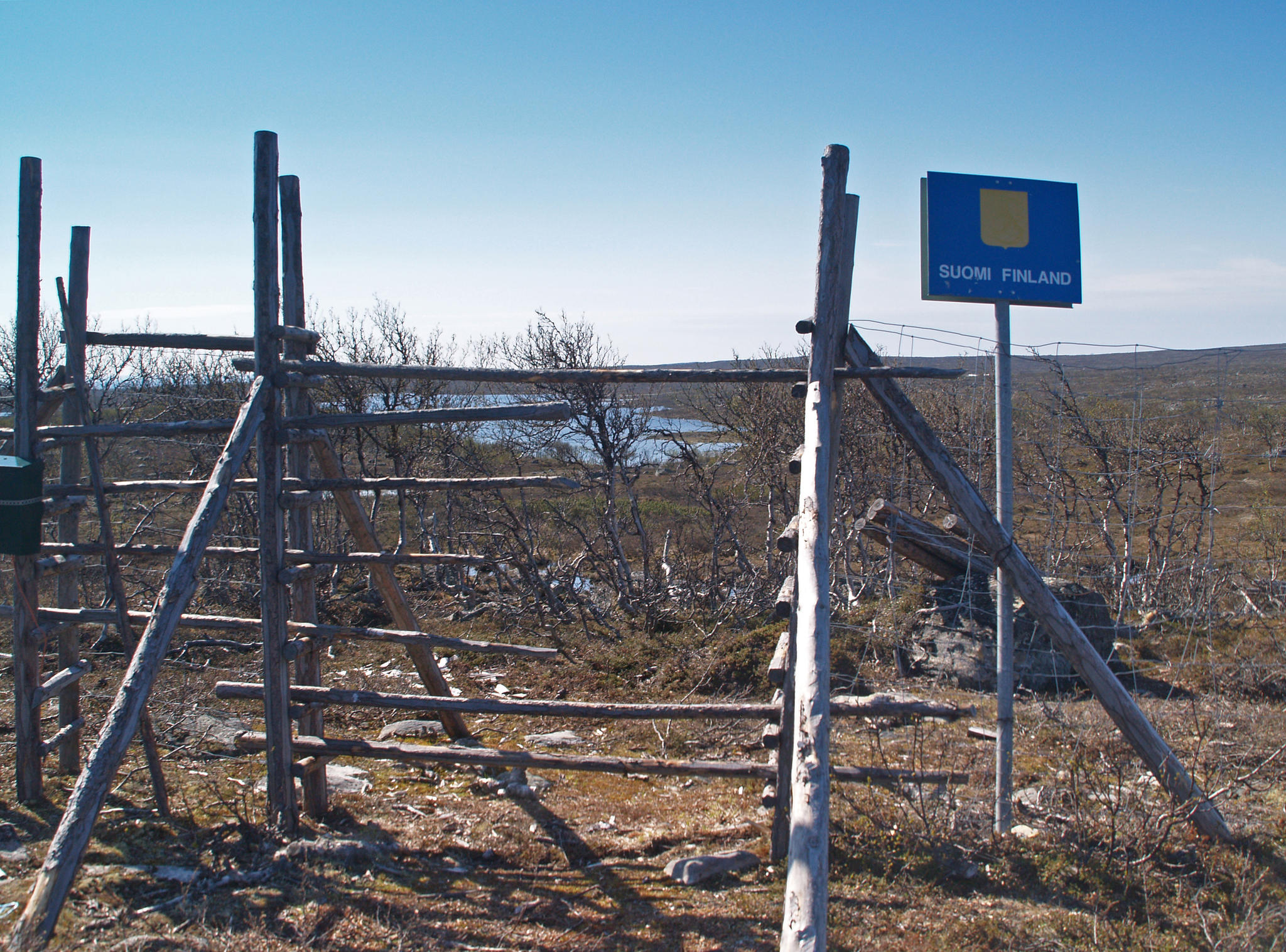
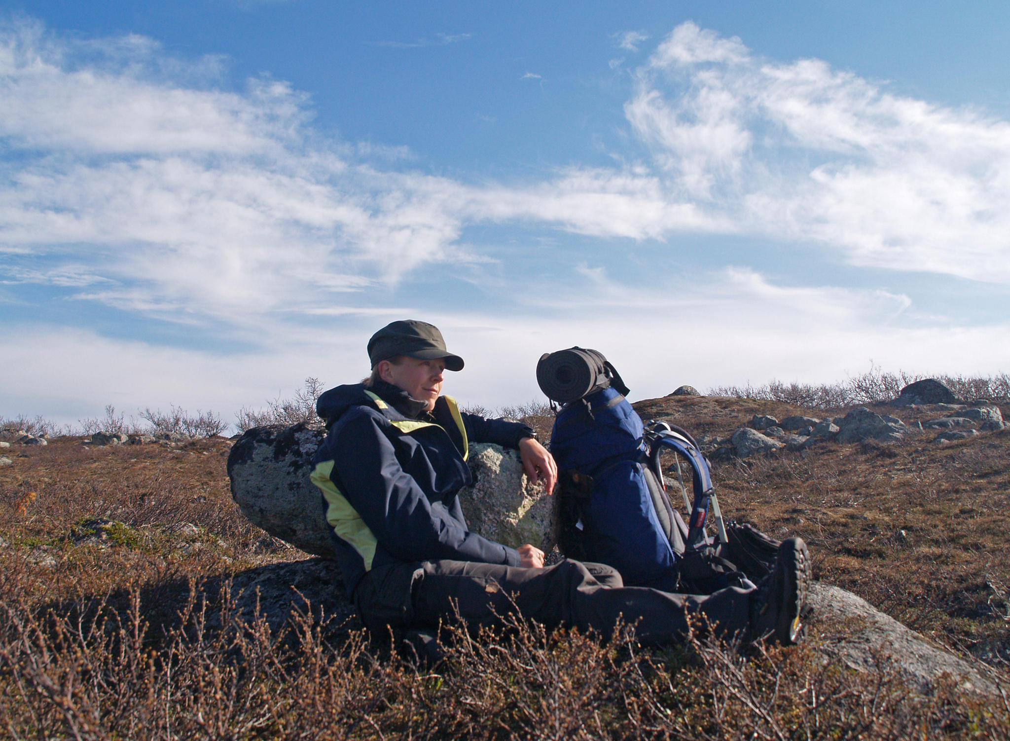
Morning routine. Then to the border. At the border is a fence. Trail goes to a spot where you can shift a few wooden beams and climb through. At the Norwegian side is a post box. Norwegians haven't cared to mark their state. On both sides the sign is from the Finns. At the Finnish side saying that it's the state border and at the Norwegian side saying that there begins Republic of Finland.
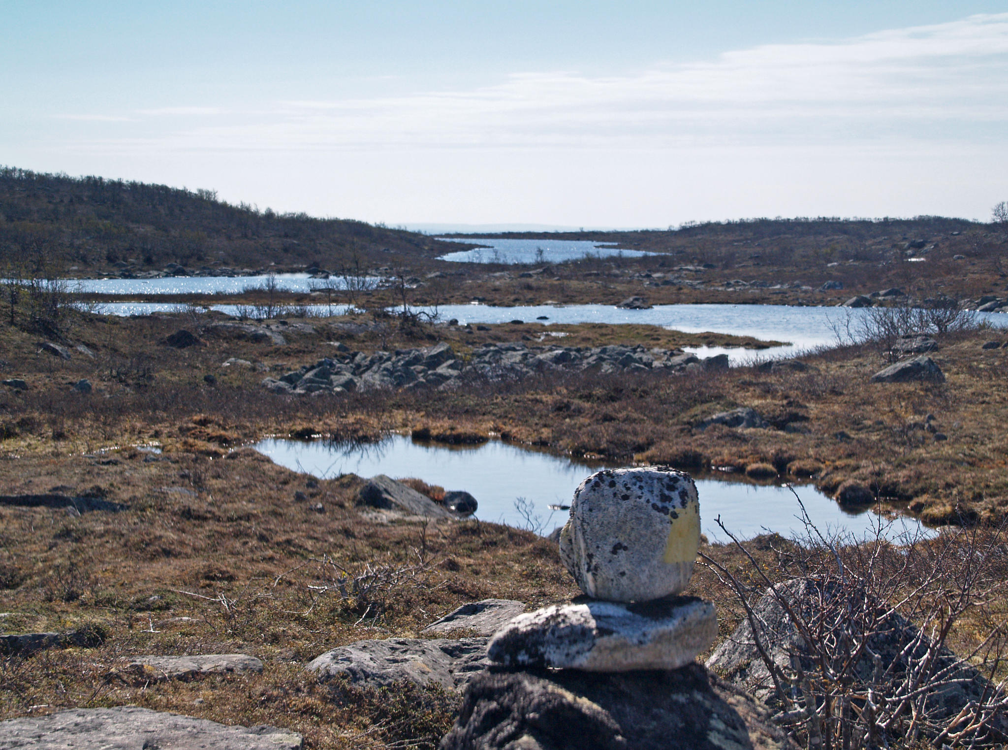
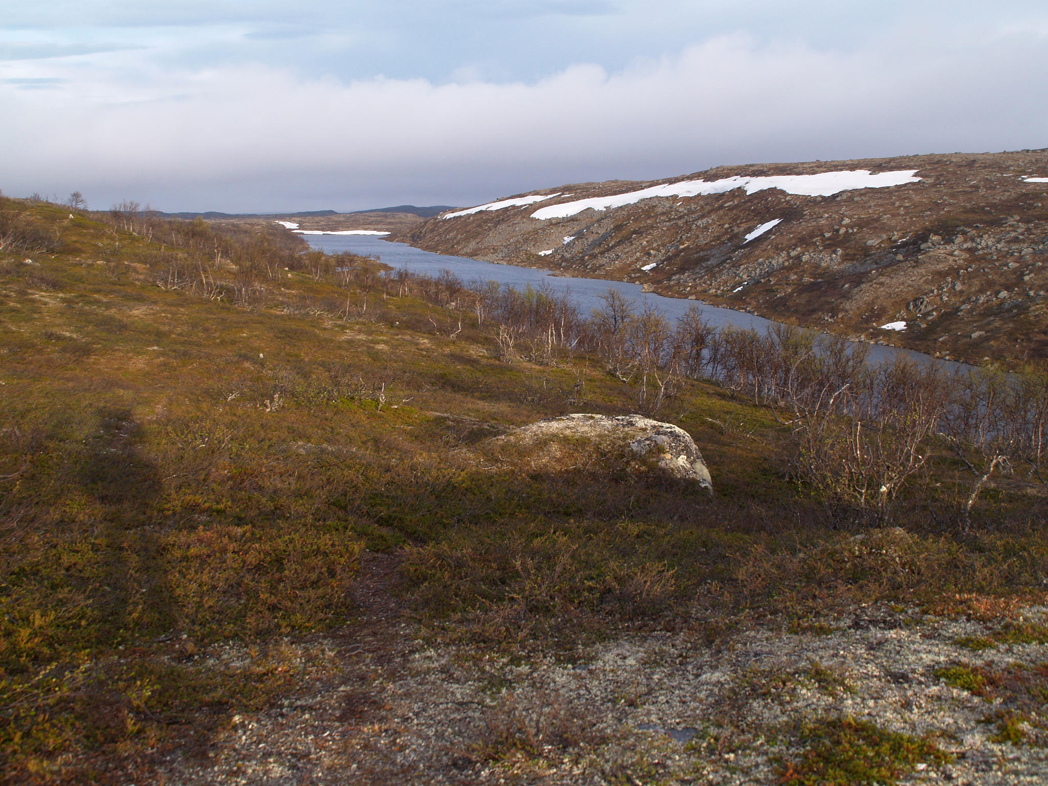
First the trail marks are visible also in Norway. Yellow marks and/or stones put on top of each other, exactly as promised. Even the trail is visible now and then. I still keep an eye on the map. A lot of small lakes, all clear blue. Otherwise the landscape consists mostly of stones and lichen. There's wind in Norway. Probably the same that was absent in Finland.
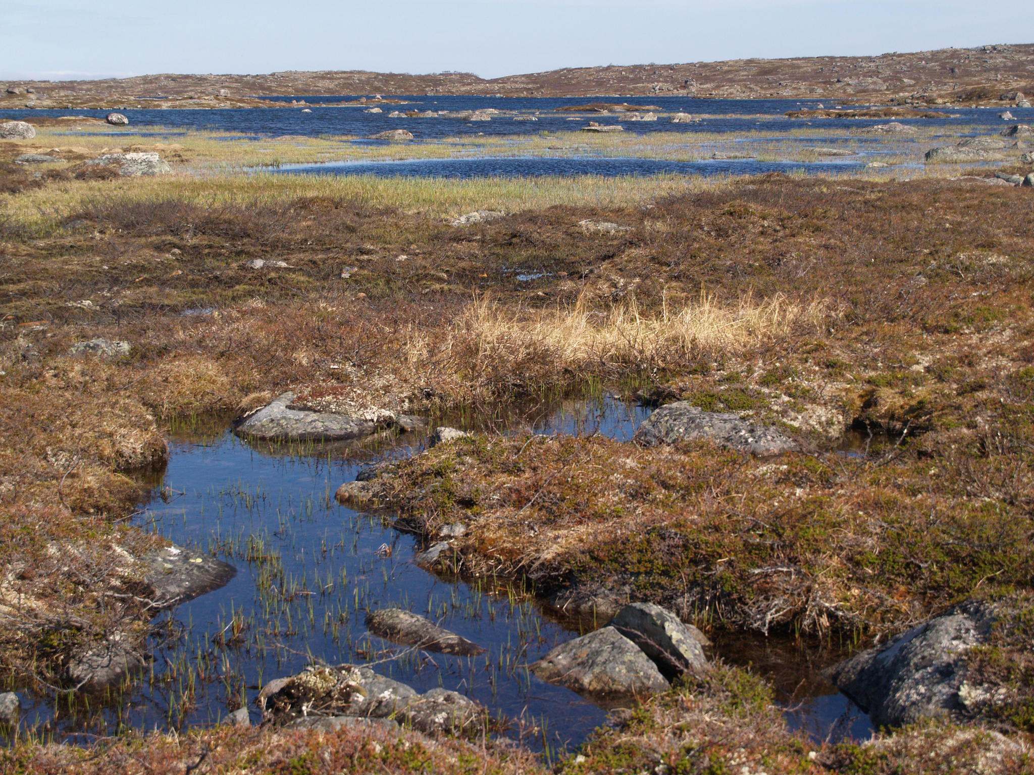
All is fine until some time after picnic. Then as well trail as the signs disappear. I wander here and there but nothing. Then I start to fear that with this walking around I'll get totally lost. So I switch to compass-map-mode. As could be guessed these damn waterholes are quite indistinguishable because from close it's impossible to figure out their shape and whether the water visible on both sides of some hill is one and the same or two different ones. Besides there's probably more water than there should be during snow melting. Yeah. When I'm completely puzzled I just start heading north. Quite a lot of climbing over rocks and through swamp turfs. Yes, through. Birds fly from under my feet, I scare a duck from it's nest. Some swallows dive towards me wishing to scare me off. Going already. In small streams is so much fish that one could catch them with bare hands. Inside hillocks live fat hamster-sized rodents whose holes stretch from one hillock to the other and beyond.
Higher hills that I avoided until then are now of help. From there it's better view. On a specially high place the view is even 360 degrees. I match the map with landscape. Something starts looking right. It seems I'm going to the right direction and during lunch break I'm happy with myself. Next to the corner of a big lake is a water in exactly the right place. The joy does not last for long. After some time map and landscape do not match anymore. I'm still in another place. Well, according to kilometers it did seem a bit too optimistic. Crossing another river I meet the trail marks again. Two of them. Like on Senja island. A bit more orientating with compass, crossing rivers (water is damn cold) and meeting three whooper swans when the trail appears again. Nice. Now I don't let it out of my sight. Dark blue mist approaches from north. Between rocks are now birches but here too some of them are dead. Strange. There's some small dark green lichen on their branches.
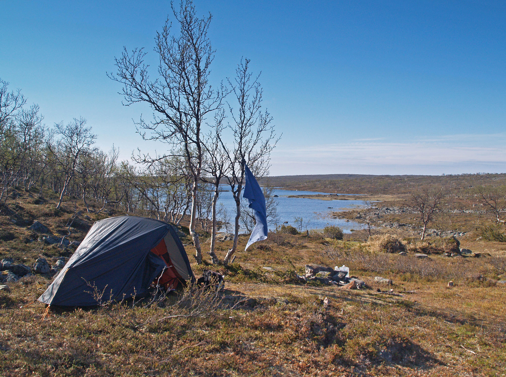
I start to get sleepy. I've walked enough kilometers but I don't think I'm as far as I'd like to be. I don't understand how much I lost or won with my detours. Trail goes on a steep mountain slope. No way to put a tent up here. Strong wind too. Finally I find a flat dry place next to a stream. And wind dies down. Like per order.
Today is colder than yesterday. I'm clearly moving north. Fast dinner, tent up and typing continues in sleeping bag this evening.
GPS: 26,6 km, moving time 08:01, stopped time 04:22, moving average for the whole time 3,6 km/h. Start ca 10:15, finish ca 22:20.
Morning routine. Then to the border. At the border is a fence. Trail goes to a spot where you can shift a few wooden beams and climb through. At the Norwegian side is a post box. Norwegians haven't cared to mark their state. On both sides the sign is from the Finns. At the Finnish side saying that it's the state border and at the Norwegian side saying that there begins Republic of Finland.
First the trail marks are visible also in Norway. Yellow marks and/or stones put on top of each other, exactly as promised. Even the trail is visible now and then. I still keep an eye on the map. A lot of small lakes, all clear blue. Otherwise the landscape consists mostly of stones and lichen. There's wind in Norway. Probably the same that was absent in Finland.
All is fine until some time after picnic. Then as well trail as the signs disappear. I wander here and there but nothing. Then I start to fear that with this walking around I'll get totally lost. So I switch to compass-map-mode. As could be guessed these damn waterholes are quite indistinguishable because from close it's impossible to figure out their shape and whether the water visible on both sides of some hill is one and the same or two different ones. Besides there's probably more water than there should be during snow melting. Yeah. When I'm completely puzzled I just start heading north. Quite a lot of climbing over rocks and through swamp turfs. Yes, through. Birds fly from under my feet, I scare a duck from it's nest. Some swallows dive towards me wishing to scare me off. Going already. In small streams is so much fish that one could catch them with bare hands. Inside hillocks live fat hamster-sized rodents whose holes stretch from one hillock to the other and beyond.
Higher hills that I avoided until then are now of help. From there it's better view. On a specially high place the view is even 360 degrees. I match the map with landscape. Something starts looking right. It seems I'm going to the right direction and during lunch break I'm happy with myself. Next to the corner of a big lake is a water in exactly the right place. The joy does not last for long. After some time map and landscape do not match anymore. I'm still in another place. Well, according to kilometers it did seem a bit too optimistic. Crossing another river I meet the trail marks again. Two of them. Like on Senja island. A bit more orientating with compass, crossing rivers (water is damn cold) and meeting three whooper swans when the trail appears again. Nice. Now I don't let it out of my sight. Dark blue mist approaches from north. Between rocks are now birches but here too some of them are dead. Strange. There's some small dark green lichen on their branches.
I start to get sleepy. I've walked enough kilometers but I don't think I'm as far as I'd like to be. I don't understand how much I lost or won with my detours. Trail goes on a steep mountain slope. No way to put a tent up here. Strong wind too. Finally I find a flat dry place next to a stream. And wind dies down. Like per order.
Today is colder than yesterday. I'm clearly moving north. Fast dinner, tent up and typing continues in sleeping bag this evening.
GPS: 26,6 km, moving time 08:01, stopped time 04:22, moving average for the whole time 3,6 km/h. Start ca 10:15, finish ca 22:20.

Add a comment